Into the Great Basin
I followed UT-130 north out of Cedar City to Milford. This road goes through basin and range country rather than the Colorado Plateau. At Milford, I caught UT-21 west. I stopped at a historic marker at the old site of Frisco (once a town of 4000, now there are no obvious traces). Immediately after I a pickup coming the other way turned out the be last vehicle saw for the next 45 minutes! The road was that deserted. I crossed the Wah Wah Valley, Wah Wah Mountains, Pine Valley, the foothills of the Tunnel Springs Mountains, and was into Antelope Valley before seeing another car. I stopped several times to photograph some representative areas on the way.
As I neared the Nevada border I noticed a lake (Pruess Lake) on my left. I stopped to scan for waterfowl and increased my triplist a bit. There were Avocets and Stilts, a Cormorant (new!), Great Blue Herons, and some waterfowl.
Before long I arrived at Great Basin National Park (passing through part of the Humboldt National Forest on the way). I asked the ranger about conditions on the Wheeler Peak trail. Apparently it is ok. Tomorrow I will do some other hikes in the area to try to judge if I'm up to that kind of hike at that altitude (I've never done a thirteener before). I also took a cave tour of Lehman Cave. Their specialty is something called a shield formation. Interesting, but I thought both Wind Cave and Jewel Cave last year were more impressive. Unfortunately, I forgot to check the batteries in my flash. It turned out they were almost dead. I didn't get any pictures. I'm not sure if I'll take another cave tour to get pictures or not.
I made a change of plan and will stay in Baker tomorrow and Friday (instead of Ely, which is too far away). I then drove to Ely. Outside Ely I found another lake with waterfowl. It added Canvasback and Marsh Wren to my trip list.
Ely, NV
Great Basin — Alpine Lakes
Thursday, June 12, 2003: I stopped again at Comins Lake in the Steptoe Valley, just outside Ely. I got my first Sage Thrasher and White-faced Ibis of the trip. The other birds were pretty much the same as yesterday.
There are two ranges and one basin between Ely and Baker (and the Great Basin NP visitors center). The ranges and basins really do alternate out here!
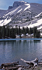
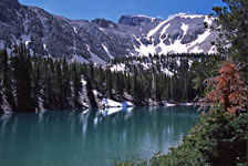
At Great Basin I warmed up with a short walk to the Osceola Ditch (it provided water for the now defunct town of Osceola). Then it was time for the Alpine Lakes Trail. The birds were not really notable, except for some young Clark's Nutcrackers being fed by their parents. The Alpine Lakes Trail passes two alpine lakes—Stella and Teresa. If you proceed counter-clockwise you then have an option to take the Bristlecone Trail.
 |
 |
 |
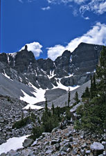
| Stella Lake | Teresa Lake | Rock Glacier |
|---|
I felt pretty good, so I took the option. It leads to a grove of ancient (up to 4000 years old) Bristlecone Pines. It's pretty amazing that these trees have survived so long. Some of them are pretty gnarly looking, but there was one 3000+ year old tree that looked like a normal tree. There are also some young Bristlecones there. It must be a good place for them.
There's another extension—to the glacier/ice body (not everyone agrees it's really a glacier). I took that as far as the first snowfield, then returned to the car. When all was said and done I'd hiked between 5 and 6 miles with an gross elevation gain (and loss) of about 800 feet. Felt great! I think high-elevation hiking agrees with me.
At the visitors center I bought a book about the ecology of the great basin—“Sagebrush Ocean”. I spent part of the late afternoon reading it so I'll understand better what I'm seeing.
Late in the day I birded around Baker. There's a stream there, so it gives a good opportunity to increase my Nevada list. There are Barn Swallows zipping around the motel and even nesting under the eaves right outside my door. Cliff Swallows nest down the street at the post office. There is a Western Kingbird nest at the motel and another across the street. There's at least one Bullock's Oriole nest in the trees at the motel. Not bad!
Baker, NV
Wheeler Peak
Friday, June 13, 2003: Today was the big day! I got to the trailhead around 7am after some early birding around Baker. Then it was off on the trail. The first mile has hardly any elevation change. It just get's you into position near Stella Lake (by a different route from yesterday). The second mile ascends some, but it's still only a few hundred feet above Stella Lake, and about 500 feet above the trailhead. Most of the climb lies ahead.
Finally, you get up on the ridge above treeline. At about 11,500 feet it crosses a very exposed area where there are strong winds. I put on long-sleeved shirt, polartec sweater, wind shell, and gloves! There are a few stone wind shelters along the trail. I took shelter behind one to put on the additional clothing and have a snack. At this point you're perhaps a mile from the summit but still have almost half the climb ahead of you.
At about 12,000 feet I encountered a young woman coming down the trail. She had started an hour before me. I'm a relatively slow hiker, and I figured it would take me at least another hour to get to the top. It's not hard a hard peak, you just need to pace yourself and have enough endurance to keep going. I didn't find the altitude a particular problem (although when resting I sometimes forget to breathe often enough...this is common at altitude). The steep pitches further up not only encourage frequent brief (30-60 sec) rests by the combination of steepness and altitude, but also because the view becomes progressively more stunning.
As you climb, Stella Lake reappears below you. Then Teresa Lake pops into view. Finally, Brown Lake (near the Bristlecone Trail) joins the party. Brown Lake is named after its color (tannins, I presume) rather than a person. All of a sudden you are on the top and it is an easy (but windy) walk to the highest point. The views are spectacular. I wish I brought had my camera, but I probably would've regretted the extra weight in the pack.
At about 12,500 feet on the way down a Black Rosy Finch flew right across the path. It's a long way back to the trailhead and all too easy to slip on the loose gravel and rocks above treeline. There were a few times I almost lost my footing on the gravel (not a safety issue, just a comfort issue).
I was pretty tired when I got to the car. The various guides give the distance as between 8 and 10 miles. I would guess it's about 9. All agree that it's a climb of almost 3000 feet. Didn't do much the rest of the day. I did a loop into nearby parts of Utah where I finally put Harrier and Shirke on my trip list.
Baker, NV
Return to Salt Lake
Saturday, June 14: The first stop this morning was the Baker Archaelogical Site. The only birds there were Horned Larks, but it gave me a chance to find out a little more about the Fremont culture (contemporary of the Anasazi). When I crossed the Utah state line my Nevada list stood at 67.
I took US 6 & 50 and then US 6 back to I-15. I stopped several times to try to see some of the things described in "Sagebrush Ocean". In particular, I went to "Sevier Lake". This is where the Sevier River dies in the desert (in one of the 90+ basins in the Great Basin). Sometimes there is actually water there, but most times it's a playa. The west has had a multi-year drought, so there was no water this time.
The next real stop was the Clear Lake WMA near Delta, UT. I put White-faced Ibis on my Utah list and added Shoveler and Savannah Sparrow to the triplist. On the way back to the main road I stopped at Fort Deseret which is an adobe fort that was built to protect (Mormon) settlers during the Black Hawk War.
I briefly paused at Tintic to see the old mining sites, then it was on to Salt Lake. I had one more event planned for the trip—to see the Great Salt Lake.
Antelope Island State Park seemed like the best choice. I can't believe all of the California Gulls there! There are thousands...tens of thousands...maybe more. I also found a good-sized flotilla of Eared Grebes as a crossed the causeway. One in a while I spied an Avocet or Stilt among the gulls. I pulled off right after I got on the island and found an area where the gulls where not in the majority. It had Avocets, Stilts, Willets, and Wilson's Phalaropes. The latter two were trip birds bringing my Utah list to 136 and my trip list to 143.
Tomorrow I travel home. Hopefully, it will be uneventful.
Salt Lake City, UT
Home!
Sunday, June 15, 2003: The trip home was pretty uneventful. I did add one more bird to the triplist. As we were taxiing to the terminal at DRW I spotted a Great-tailed Grackle in one of the grassy areas.
Miami, FL